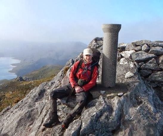
I haven't
posted any trip reports for over a year now – very lazy of me. This is my
account of a recent trip to the Frankland Range in South-west Tasmania. I was
accompanied by my good friend Nick for the first day and a half, and from there
it was solo. After 8 days, of mostly great weather, I made it out,
accomplishing nearly all of what I had set out to do. A very satisfying trip!
 |
| Setting off from the car |
.jpg) |
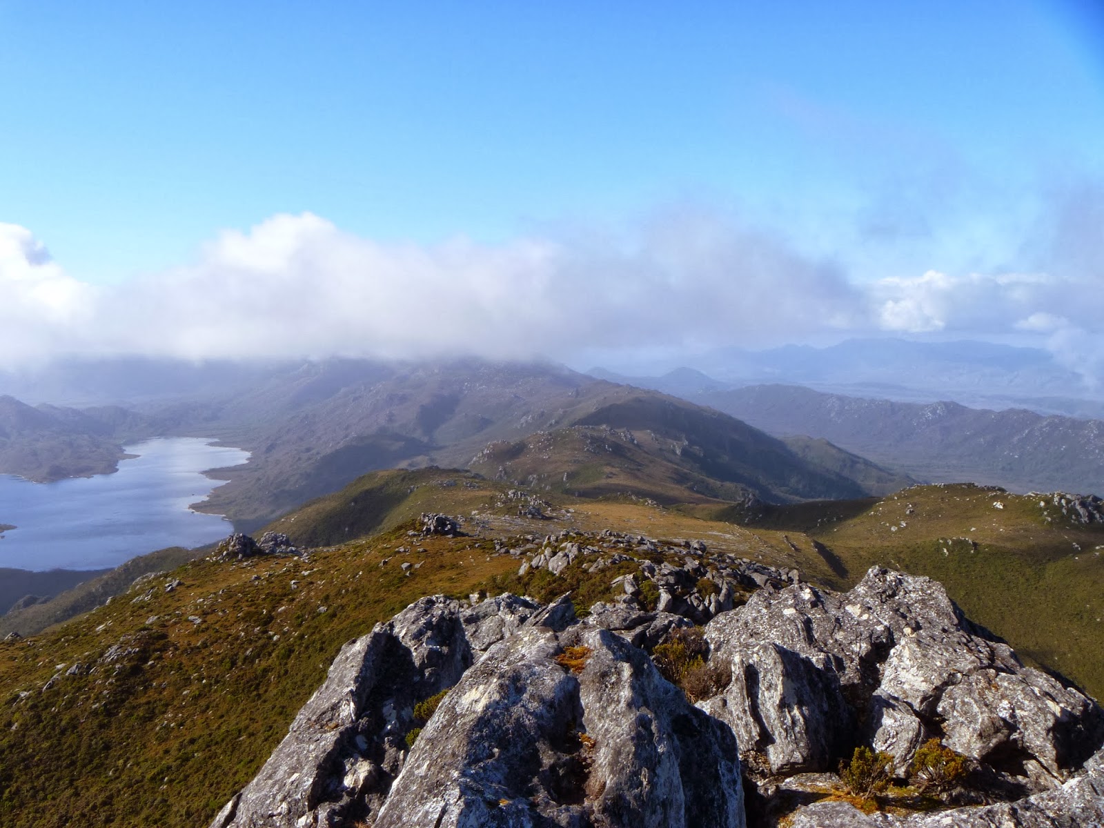
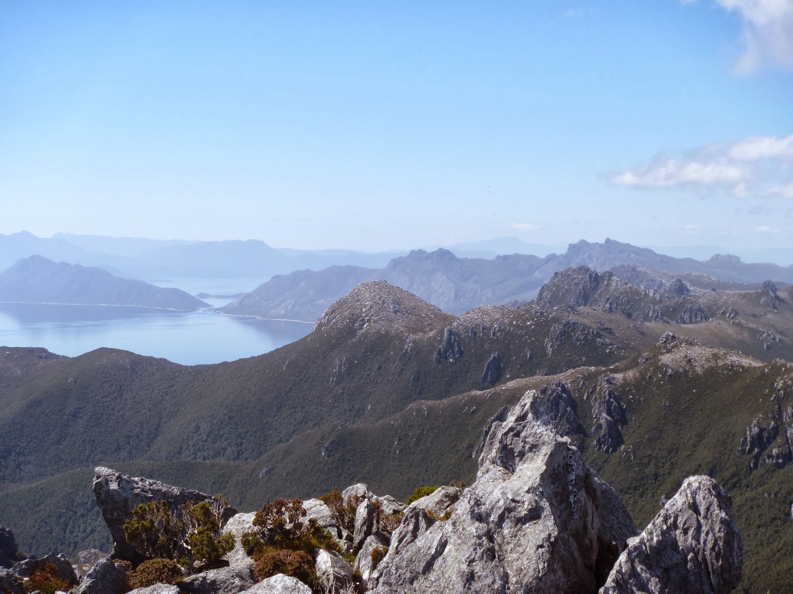
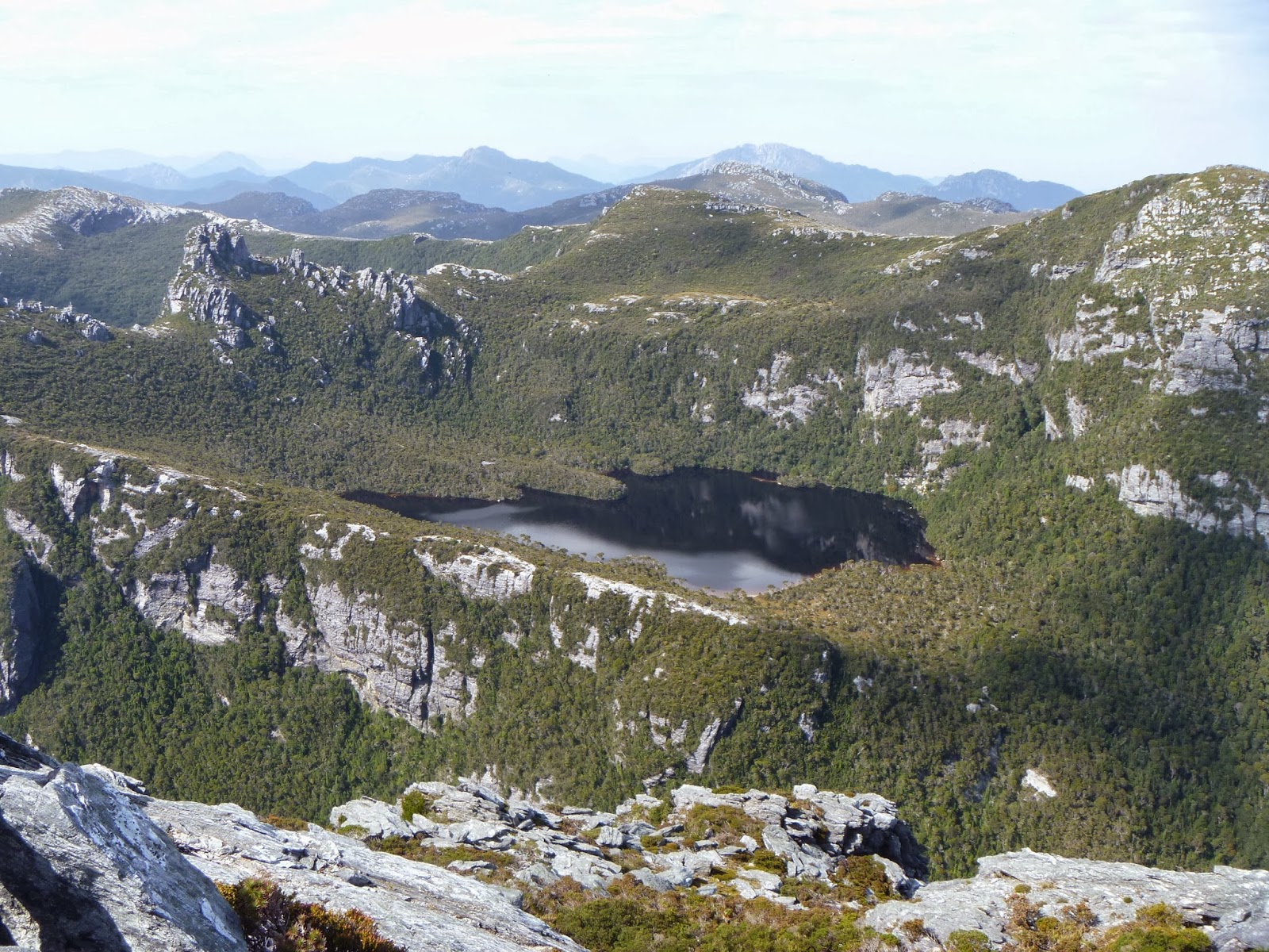
| View from Serpentine Dam |
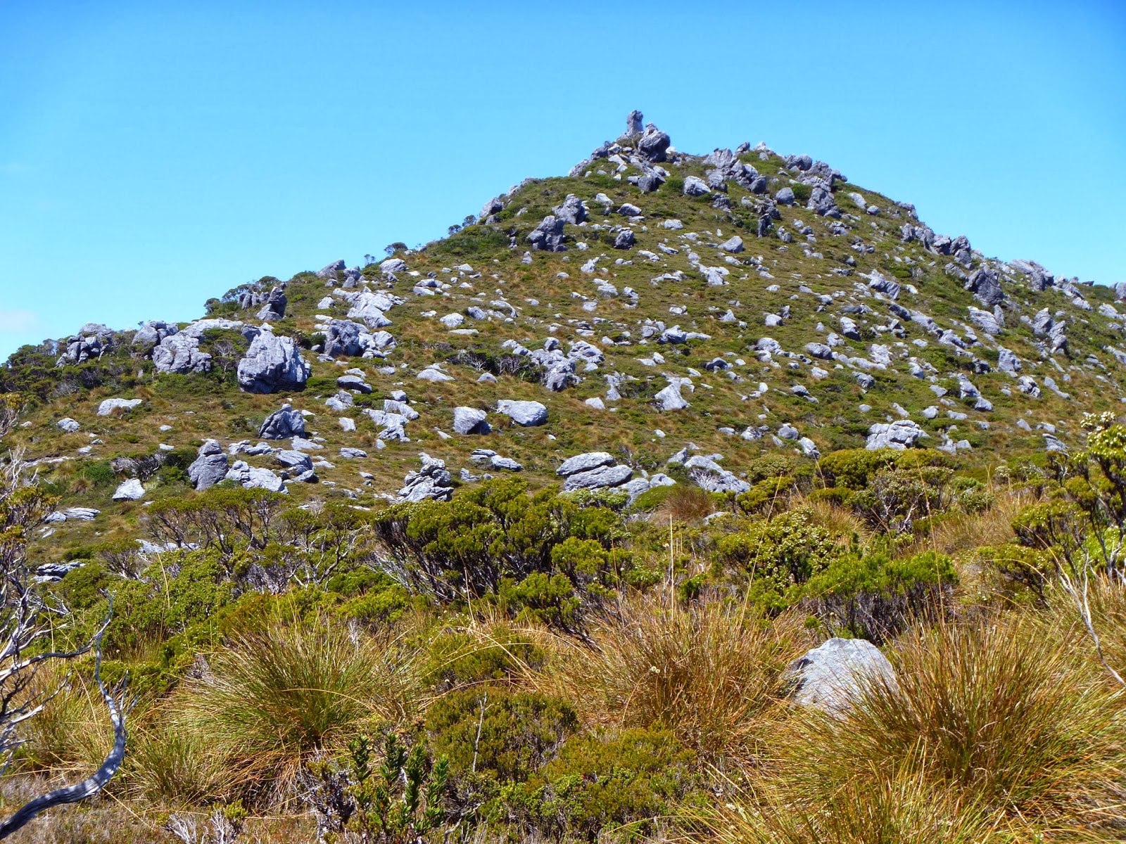
Day 1:
Serpentine Dam – Mt Sprent
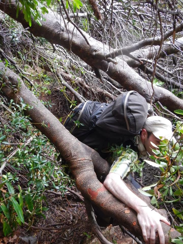 |
| The tree across the track |
After
arriving in Hobart on the Saturday night, I had a day to prepare to last bits
for the trip. I was carrying about 12 days of food, just to be sure I had
enough, and with the option of a trip up the Folded Range at the end of the
trip. My pack weighed in at 23kg, which was more than I really wanted to be
carrying, knowing the extent of the climb on day 1. Nick came and picked me up
at 7am and we drove the 2.5 hours out to Serpentine Dam, just past
Strathgordon. From here we set off, meeting our first obstacle within a minute
of walking: a large tree had fallen over the track. Not wanting to take my pack
off, I somehow squeezed underneath it. From there I signed into the log book,
and the slog up the hill began.
It took only a matter of minutes and Nick had
disappeared up the hill. He was only carrying gear for one night, so his pack
was much lighter, and admittedly I was not as fit as I once was. I was
determined just to keep at it, and eventually the climb started to flatten out.
Upon passing the clearly visible weather station, about 2/3 of the way up, the
rain started to fall. The summit was no longer in view, and it got cold very
quickly. I know I was very hesitant to drop off the summit to open ridges
without visibility, and I was relieved when Nick had the same thought. We
decided to drop camp early, finding a semi-sheltered spot on a ridge, just
below the summit. Only 20 metres below us the wind ripped across an open gully.
It was only just after midday when we arrived here.
.jpg) |
| Night one camp |
We both had a bit of a
sleep, and by the time I had woken a few hours later, the weather had passed,
and blue skies were overhead. I made a quick dash to the summit to get some
photos, and I had a look around for any pools of water to cook dinner with.
After a bit of searching I found a small pool down in a gully. We had enough
water to cook dinner, and enough to top up my bladder for the following day. We
both headed off for an early night, ready to head off down the range the next
day.
.jpg) |
| Mt Sprent Summit Trig |
.jpg) |
| View from Mt Sprent |
 |
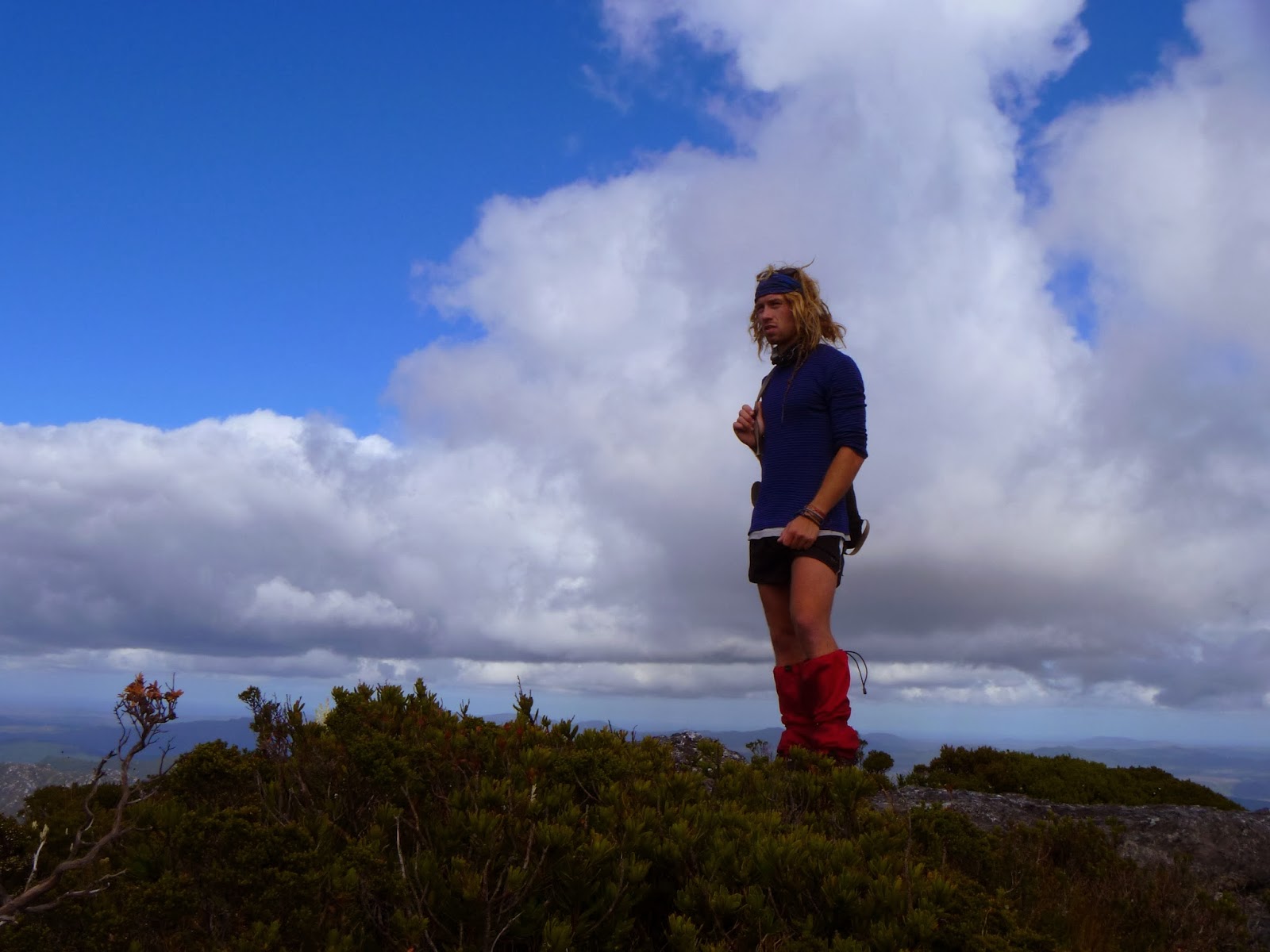
| Exhausted on the morning of day 2 - Mt Sprent Summit |
Day 2:
Mt Sprent – Below Koruna Peak
.jpg) |
| Looking down the Wilmot Range |
We woke
up fairly late and packed up our gear. Nick packed a day pack to join me for
part of the day. The sun was out, and we could see quite some way in the
distance. The initial short climb to the summit of Mt Sprent tired me out
quickly with the full pack on. My body was still adjusting to several months
without any pack carrying. We set off down the boulders below the summit,
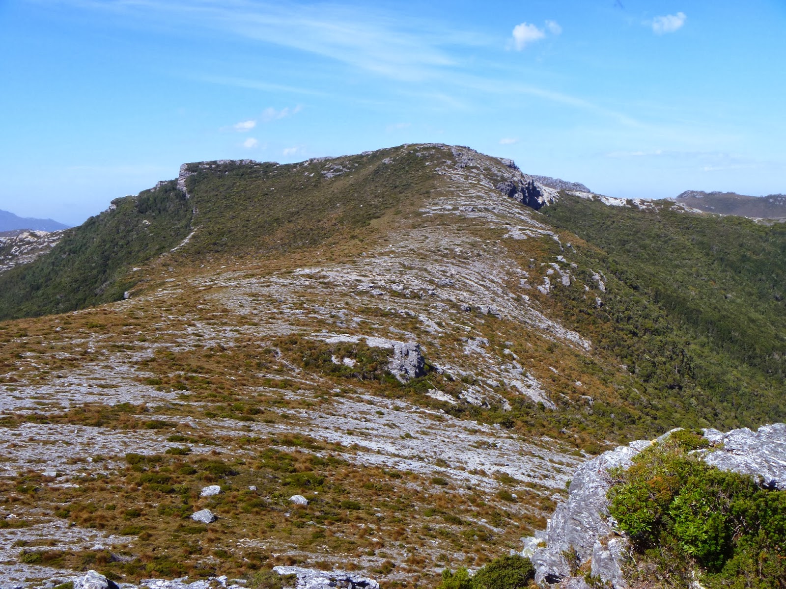
following a line of cairns to the open grassy ridges of the Wilmot Range. For
the whole way along, Koruna Peak was in view. The route passed through a
scrubby valley where a small creek passed through, but luckily we picked a line
that crossed the creek immediately where a pad up to the next ridge was
attained. On each scrubby ridge from here on there was a rough pad where it was
needed, although the walking was almost always open and easy. We made several
comments on how good the walking was. After a couple of hours of walking, Nick
had to say goodbye and head back to work the following night. It was about
11:30am when he turned around.
.jpg) |
| Nick at the point of his return - jealous of what lay ahead |
.jpg) |
| Coronation Peak in the distance |
I didn't have all that far to get to Koruna
Peak. I kept moving until I was under the base of Koruna, where I left the pack
and raced to the summit. I foolishly left the camera in the pack when I ran up.
After I returned I picked up a very well-worn track that leads to Islet Lake,
which sits directly under Koruna Peak. There were a few rough campsites here,
but it was too early to stop. I refilled water here, and had a quick snack
before setting off up the ridge to follow leads through some lovely grassy
valleys below the main ridge of the Wilmot Range. After another hour or so of
walking the track dropped down through some forest, passing a great little
bivouac cave and a creek into a sparse grassy valley, with spectacular views of
the cliffs on Koruna Peak, and the grassy tops of the Wilmot Range summits. I
decided to camp here, despite it being just after 2pm. I was already feeling
fatigued, and was keen to rest up in a place that had a good supply of water. I
was concerned that water may become scarce as the trip went on, and that proved
to be the case the next day.
.jpg) |
| Islet Lake and Koruna Peak |
.jpg) |
| Koruna Peak from my campsite |
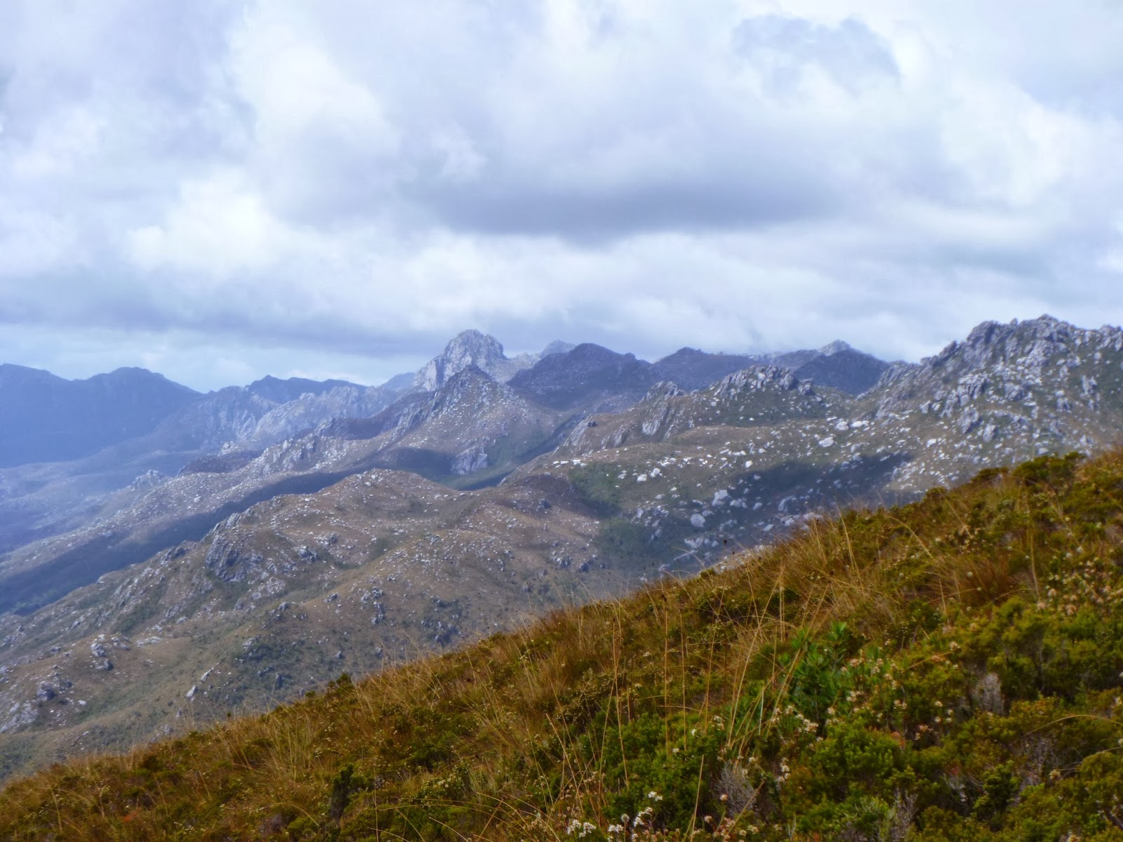
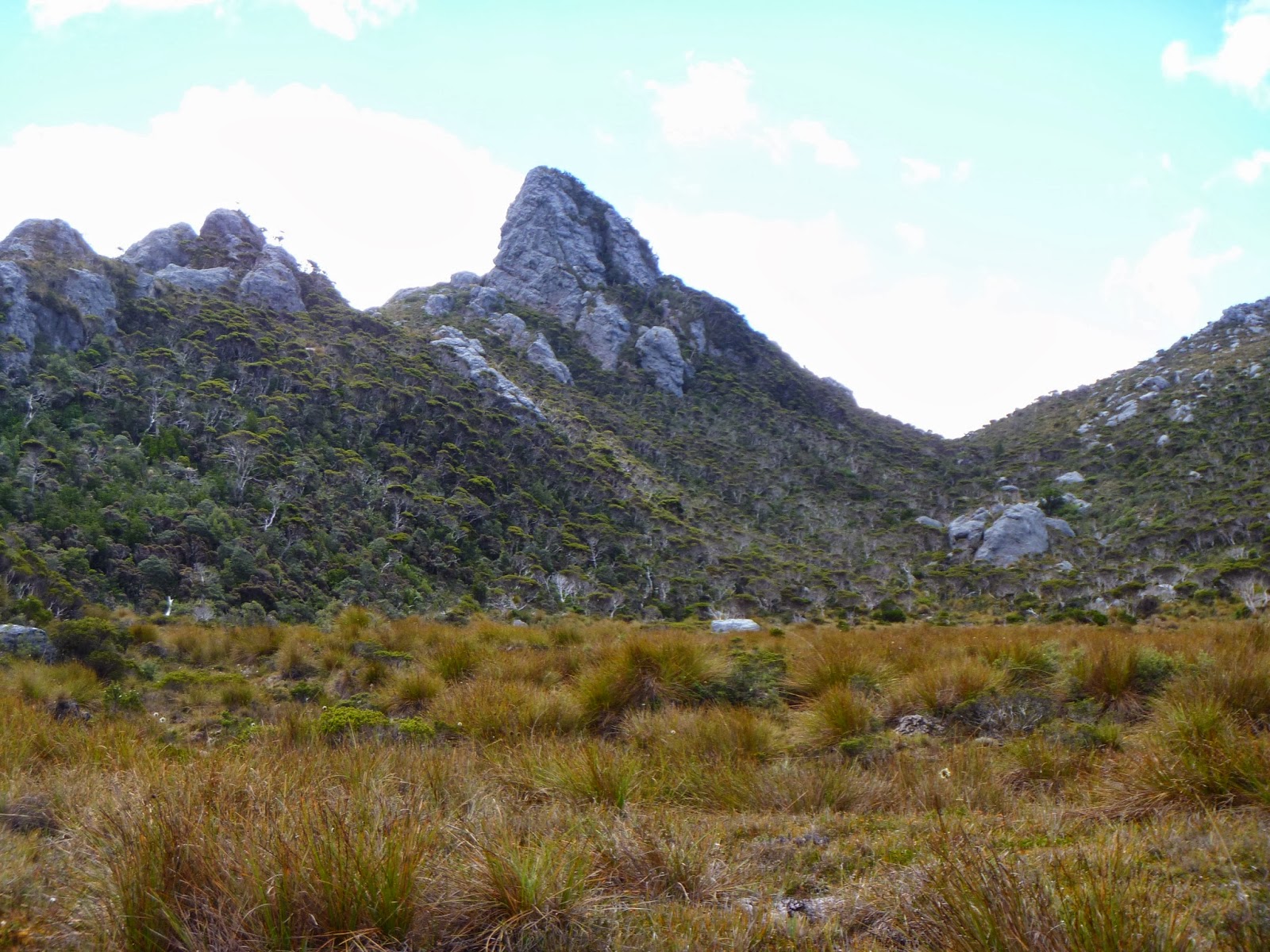
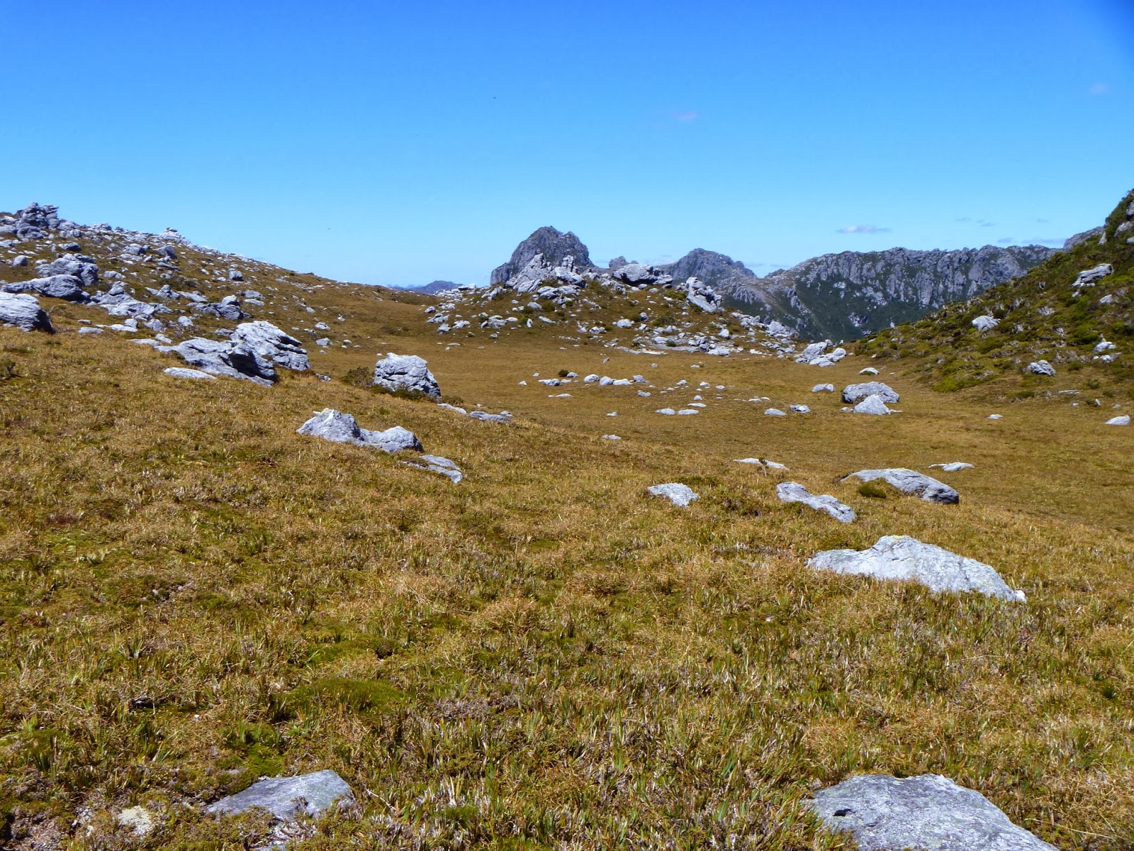
Day 3:
Wilmot Valley – Coronation Peak
.jpg) |
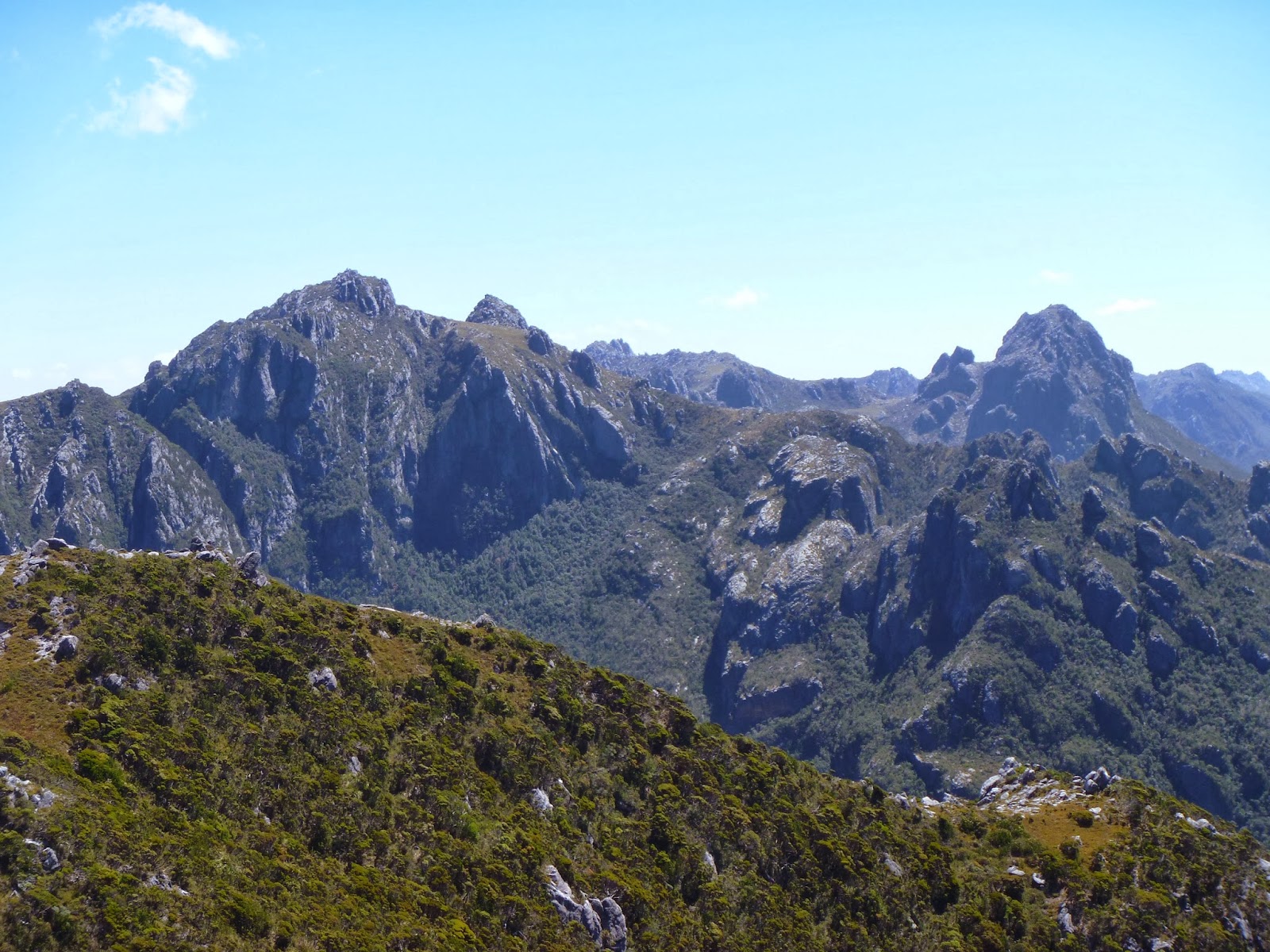
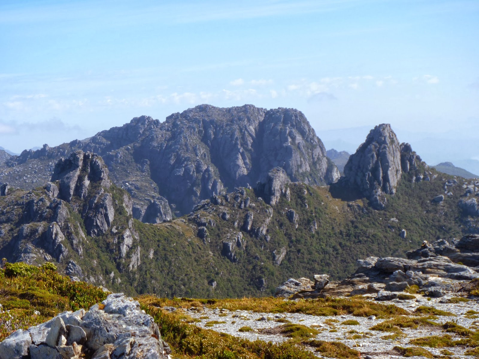
| Distinctive peak at the end of the Wilmot Range |
I woke
early to blue skies yet again. I packed up quickly, knowing that a big day was
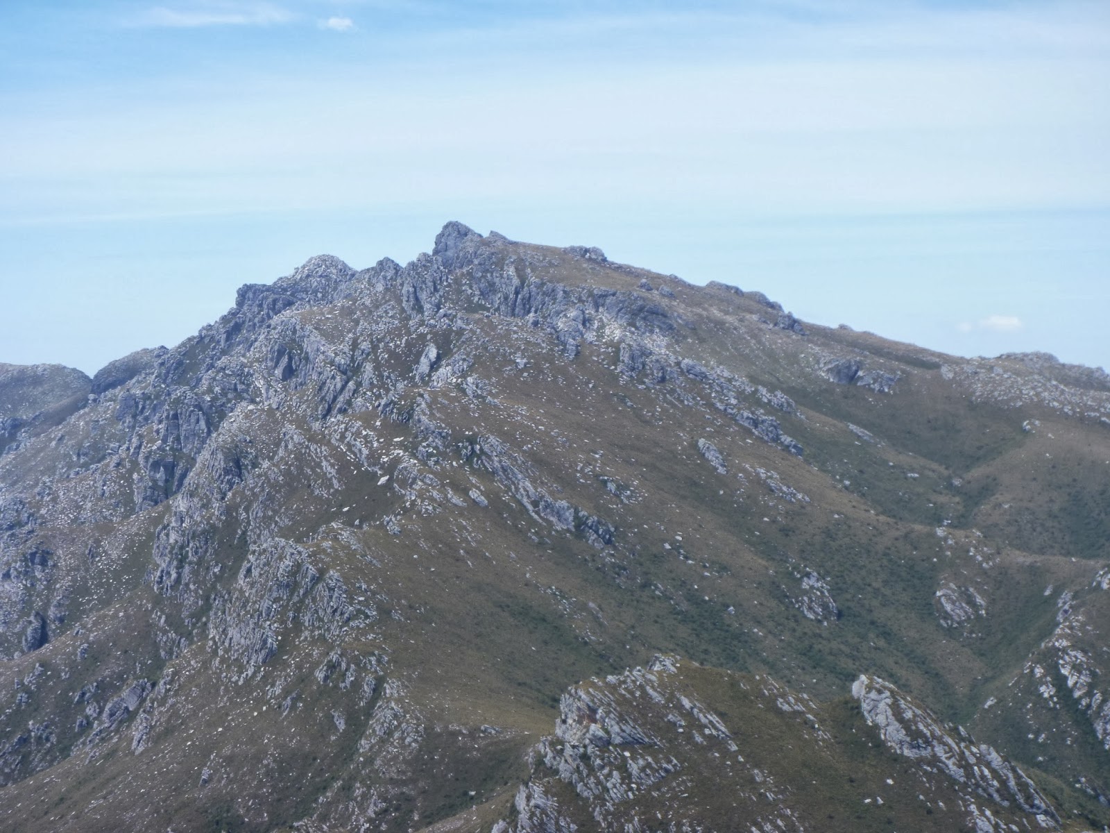
needed today. I set off and found a pad up onto the ridge top. The first summit
that is climbed has some quite distinct quartzite spires on the top. It was a
tough slog up the hill, but it felt much easier than the first two days.
Finally I was regaining a bit of fitness. After reaching the top, a track leads
steeply down to the next saddle, which had a large rocky overhang, a perfect
place for a quick snack. After climbing the next part of the ridge, I slipped
on a rock and took a chunk of skin off my left hand. It stung for a bit, but
from that point I decided it best to start wearing my scrub gloves. My arms
were already cut to pieces by scratchy Richea
scoparia and Leptospermum rupestre (Tea-tree). I pushed on and made it to the famous ‘Bowl’ campsite. It would
have been amazing to camp here, but unfortunately it was far too early for me
to stop, and I wanted to catch up some lost time from day 1 today. I topped up
my water and headed off to begin the long climb up Tribulation Ridge. It
surprised me to find it very well tracked and relatively easy to climb.
.jpg) |
| The campsite known as 'The Bowl' - Coronation Peak behind |
There
are some slightly exposed sections along the way, but nothing too scary. I
guess I found that with these ridges, there is only one way to go, so tracks
form fairly quickly. After slogging away for a couple of hours, I reached the
top of the ridge, and then it was a simple drop down to the saddle below
Coronation Peak, my camp for the night. I thought I could see water from up
higher on the ridge, but the camp was dry. I set up my camp, and then filled up
my day pack for a quick trip to the summit. The sun had been out all day, and I
couldn't resist the opportunity to go up in good weather. I wasn't sure of the
forecast for the next day. The climb follows cairns up a steep gully, with
plenty of handholds, then a short section of scree, and some amazing views. I
touched base with people at home, letting them know that I had made it to my
camp. I took a few snaps and had some dry dinner, opting to conserve water for
the following day, not knowing when the next source would be.
.jpg) |
| Coronation Peak from a high point on Tribulation Ridge |
.jpg) |
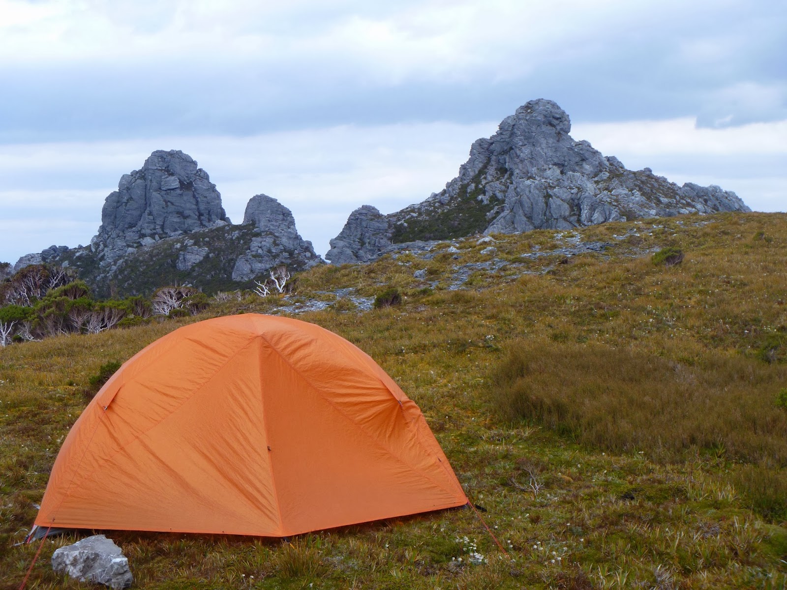
| Night 3 camp under Coronation Peak - Double Peak in the background |
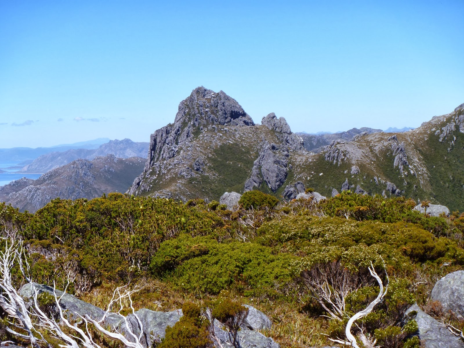
Day 4:
Coronation Peak – The Cupola
.jpg) |
| Madonna Ridge from Double Peak |
I woke
again to blue skies. I couldn't believe my luck! I packed up and set off to
Double Peak. I made a slight blunder, thinking I had to pass over the first of
the summits. This proved to be somewhat dangerous. I ascended a steep gully, and
then had some airy scrambling, only to end at a point of no return. I decided
to head back down and sidle underneath to the summit saddle. I then found the
cairned route, and it all became very simple. I made it to the summit when an
old trig station used to stand. Some concrete and bit of iron still sat on the
ground. The decent to Madonna Ridge was quite simple. Tracks existed when
needed. The track then climbed to Redtop Peak, where I again had great views, and
then I quickly headed to the saddle underneath to begin the climb to The
Cupola. I had not found water at any point during the day, so I was getting
desperate for water. I'd looked for yabby holes, but they were also very dry.
.jpg) |
| Looking down the range |
.jpg) |
| Double Peak and Coronation Peak from Redtop Peak |
.jpg) |
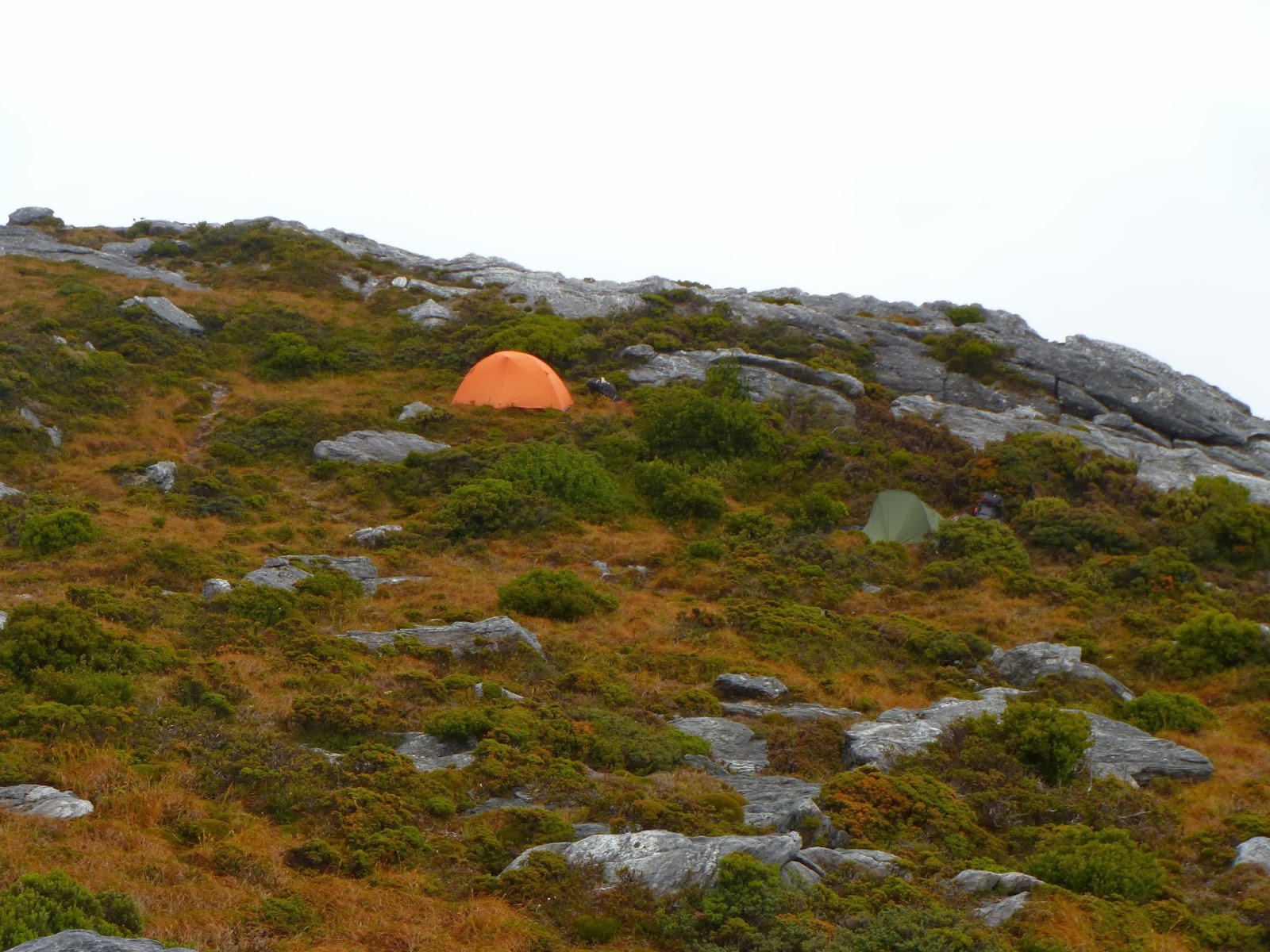
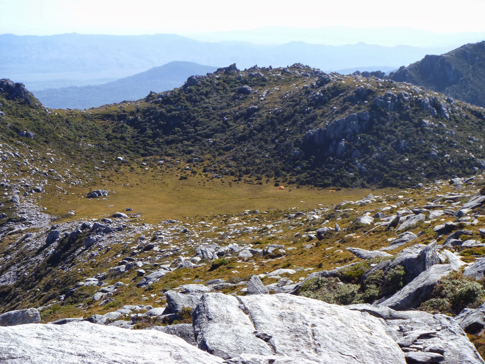
| The Cupola bowl - you can see my tent on the right |
I
finally made the push up to the saddle above The Cupola, where I could clearly
see a creek running through the grassy bowl where I would camp the night. I
rushed down and filled up on water and electrolytes. I had a quick snooze in
the shade before running up to the summit. I spent quite a time up the top,
until the march flies got too much for me. I was able to have a hot dinner and
a really good night's sleep. Sunset was quite beautiful watching from the
Cupola bowl. It had been a relatively short day, a welcome relief from the
previous day, and knowing the next day could also be short was appealing.
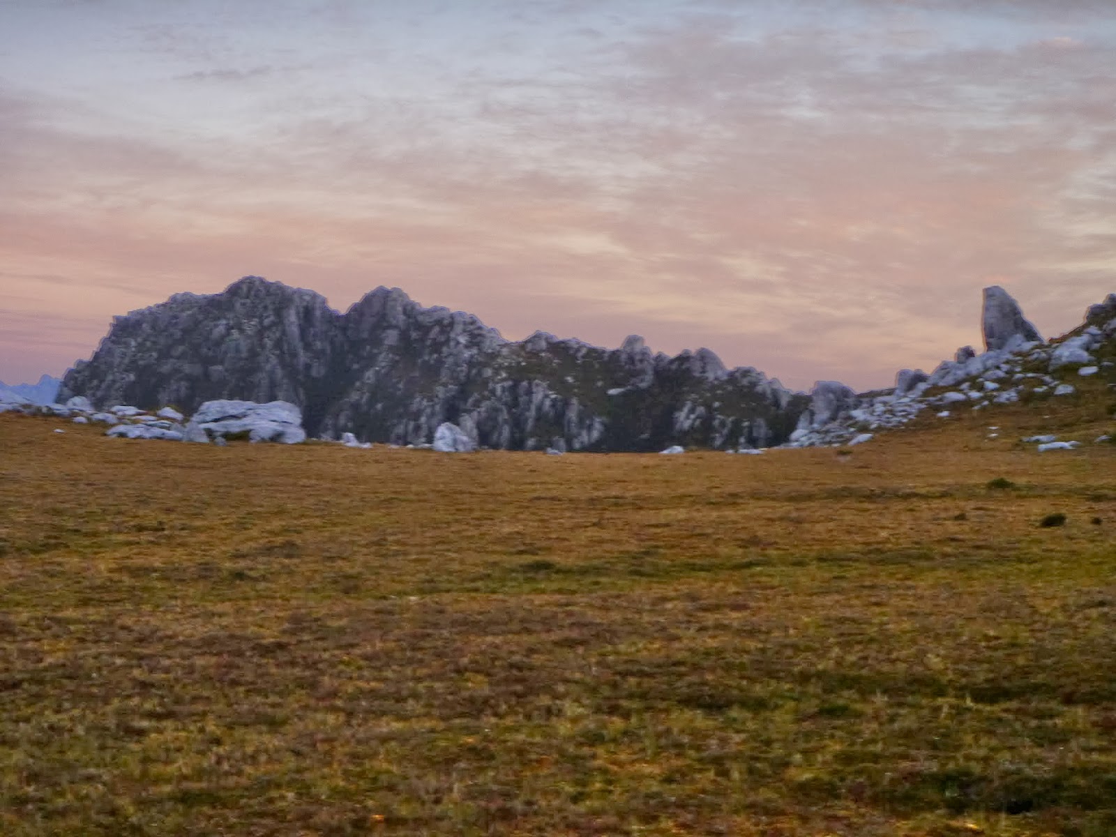.jpg) |
| Sunset and The Lion from my tent in the Cupola bowl |
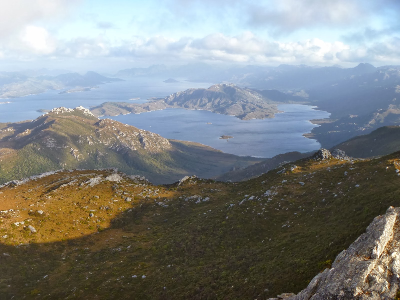
Day 5:
The Cupola – Citadel Shelf
.jpg) |
| The Moat and Citadel Shelf from The Lion |
Surprise,
surprise – blue skies!! I woke just
before 7am, and packed up my gear. I was keen to climb the peaks while the
weather was still good. I was sure it was going to crack at some point. I
quickly climbed the ridge to head out to The Lion. I dropped the pack and
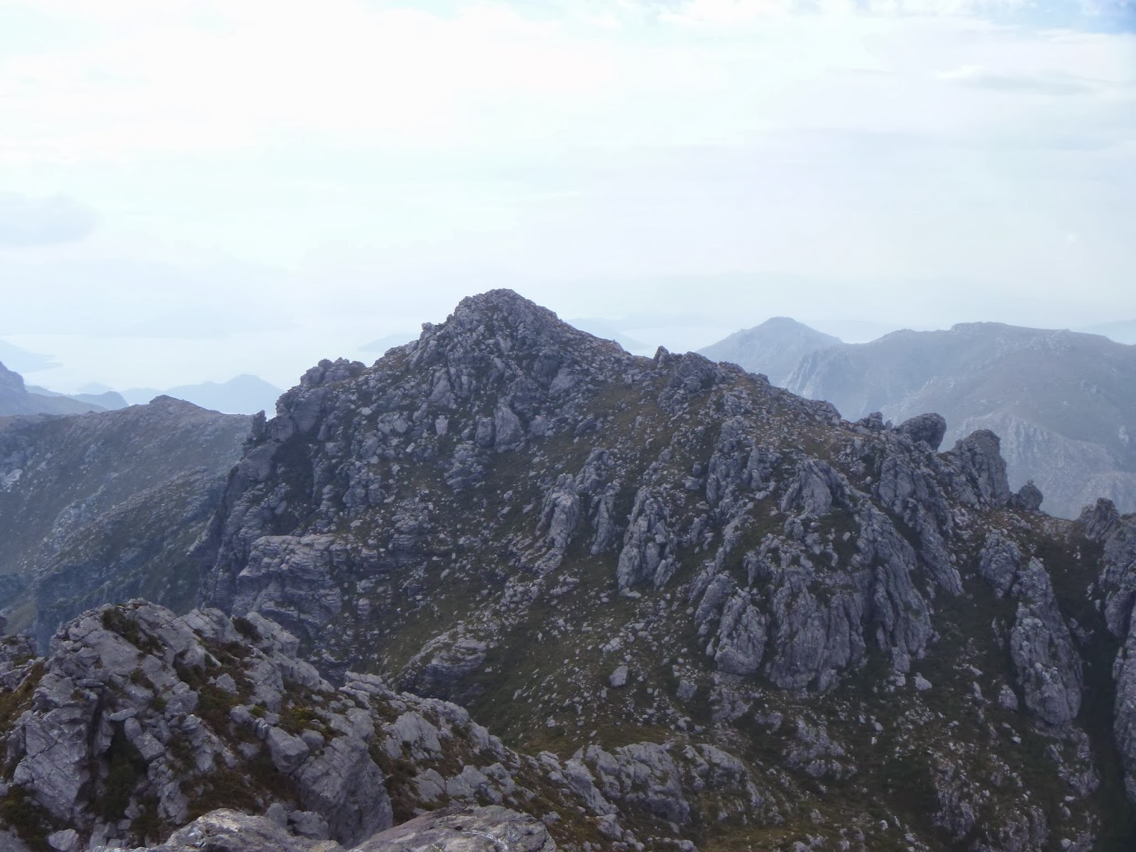
headed out down the open ridge. For me, The Lion was the most fun summit to
climb, and possibly the best views. The track sidles underneath the cliffs of
The Lion, some tight boulder-y corners and horizontal in places too. After half
an hour of walking from where I dropped my pack, I was on the summit. There
were great views to The Cupola, and to The Citadel, as well as all the way back
along the range.
.jpg) |
| The Gully! |
I headed back and picked up my pack for the fairly short
journey to the Citadel shelf. I arrived there at around 11am. I set up camp and
the grey clouds started to come in. I thought I best go and climb the Citadel
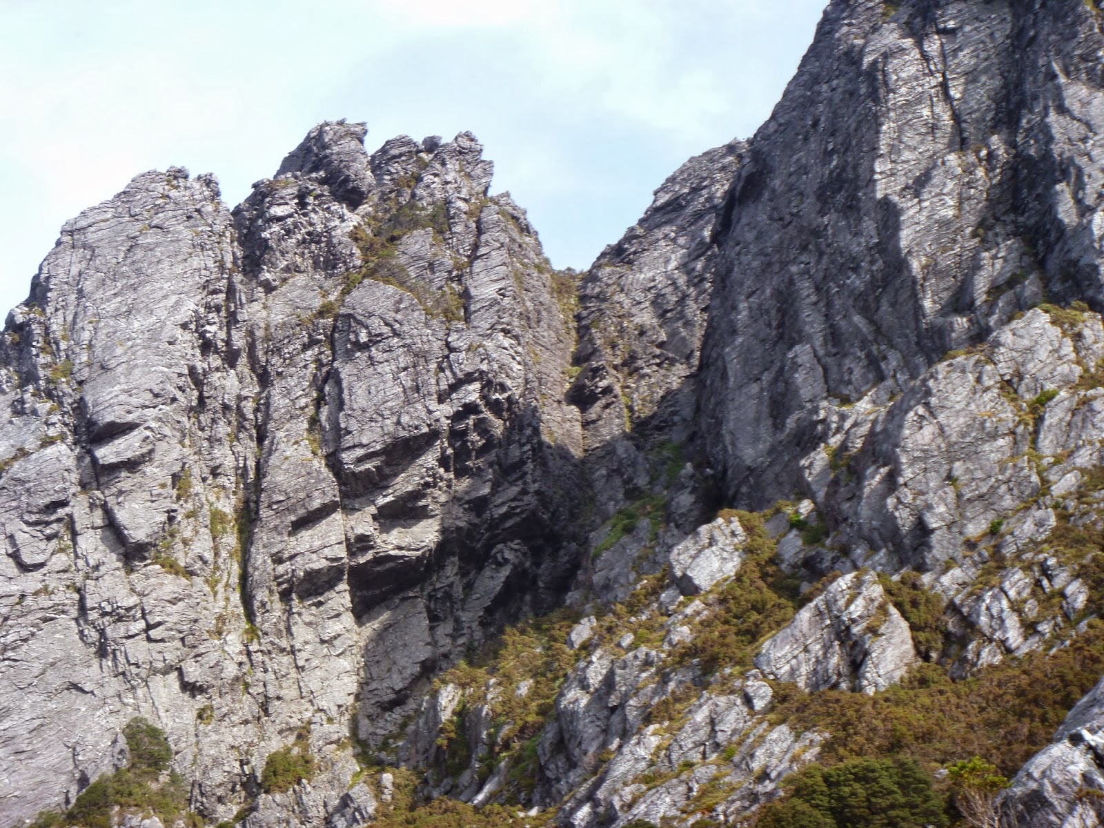
while it was still dry, knowing there was a steep gully climb. I started
walking out down the track to the spires, almost stepping on a tiger snake
along the way. The track sidles around the western Citadel and leads directly
to the steep gully which climbs to the summit of the eastern Citadel. I quickly
started my way up the gully, having no major issues with its airiness, but as I
got higher I began to worry about the descent. I have never been a confident
descender. I reached the summit and took a few photos and began to focus on the
descent. I actually found it to be easier than the ascent, and I didn't feel
unsafe at any point.
.jpg) |
| The Moat from near the summit of The Citadel |
.jpg) |
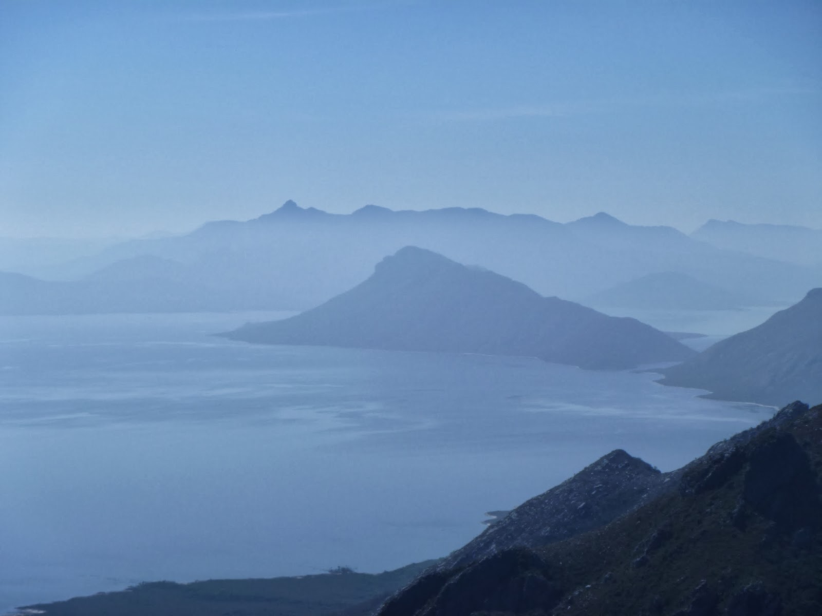
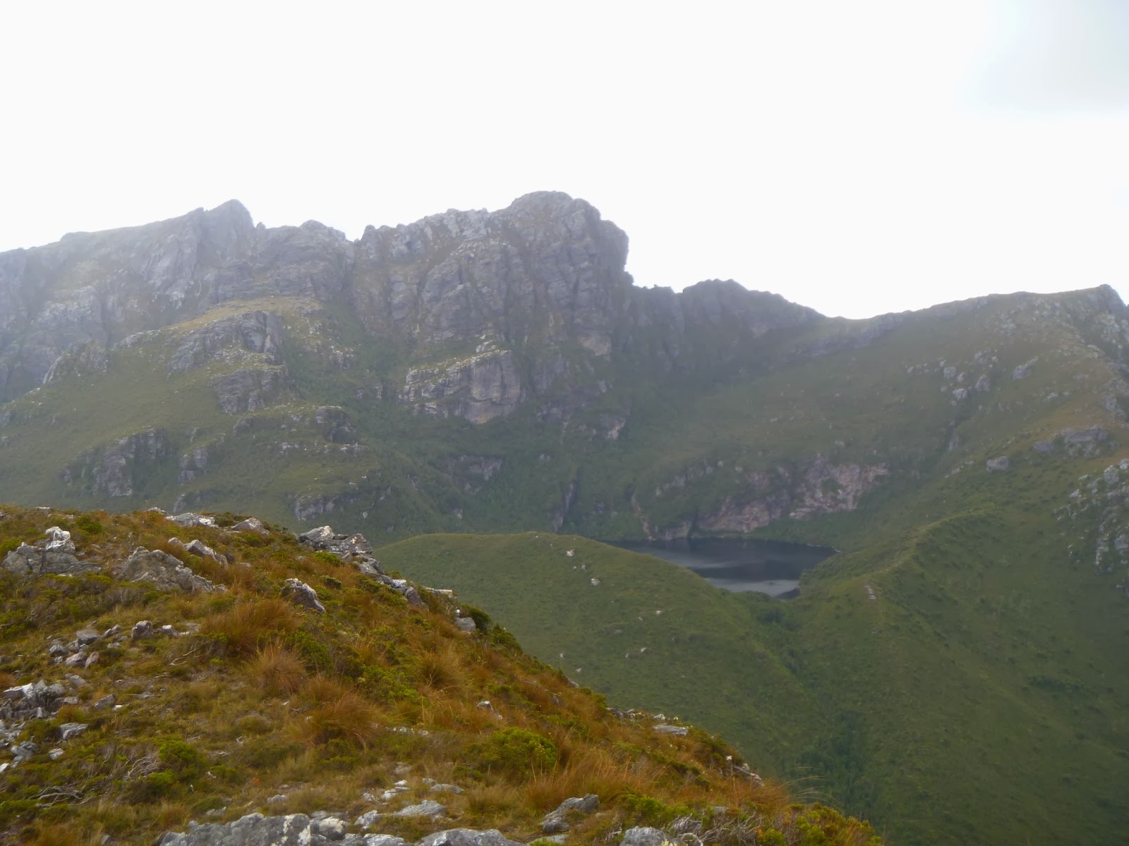
| Croaking Lake and Remote Peak |
After
getting back to the campsite, it was still before 2pm, and the clouds, while
they were grey, didn't look overly threatening. I had read that the trip to
Remote Peak was only 3-6 hours, and I thought I would be on the quicker side of
those times, so I decided to go for it. The trip out is through burnt valleys,
quite a sight, and I imagine it wouldn't have been a pleasant trip before the
fire went through. I made it out to Croaking Lake in 45 minutes, thinking it
would take another 30 minutes to the summit. While there were no pads out here,
it was easy to just zig-zag up the rocky ledges to the summit. The clouds were
still grey, but I wasn't worried about rain. I made it to the summit, and then
returned by a slightly different route, trying to find an easier path to the
main ridge. I made it back to the campsite in just over 3 hours; it was about
5:20pm. I cooked up some food and had a good night's sleep, after a fairly
long, but easy day.
.jpg) |
| Citadel Shelf camp with the Citadels keeping watch |
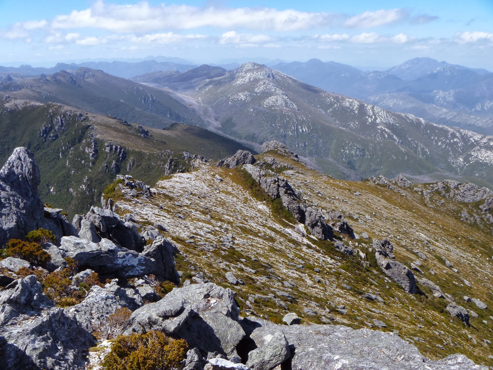
Day 6:
Citadel Shelf – Right Angle Peak
.jpg) |
| Views of The Lion and The Citadels from Murphy's Bluff |
Today
was the one day I was really concerned about water. I wasn't sure whether
Frankland Saddle would have any water. The first summit of the day was the easy
stroll out to Murphy's Bluff. Views here were quite good. The range was fairly
open up until Cleft Peak, with some amazing views down to Frankland Shore.
After Cleft, the route descend through some thick tea-tree, and then in some
clumpy button grass. It was quite a warm day, blue skies yet again. As the
range climbed up the uninspiring Greycap, I was getting very tired, and there
was very little evidence of a track up here.
.jpg) |
| A misty Mt Anne |
.jpg) |
| Open ridge walking |
The route from the top of Greycap
suggested I had to go over some bumps, but it turned out that it is best to go
underneath them, until the last one, where the route heads down the hill in the
saddle between the last two peaks. The walking was easy enough, but more grass
to frustrate me, and still very dry. The weather started to change up as I
headed up over the last hill before Frankland Saddle. I thought the rain was
definitely coming this time. I reached Frankland Saddle and went looking for
water. I was almost down to my last litre. I was planning to camp here, but the
lack of water prompted me to keep moving up to Right Angle Peak, in the hope of
a stream up there. As I started climbing up the ridge toward Frankland Peak, it
started to drizzle, but nothing much. I stopped and put on my rain jacket just
in case it got heavier. The rain stopped about 2 minutes later. I kept pushing
up the hill, and I was getting very tired. I struggled over the last 20
minutes, but eventually I made it to the saddle I was aiming for. I went
searching for water again, but I found nothing. I had to bite the bullet and
set up camp anyway, it was fairly late in the afternoon. I found a ledge that
had shelter from the easterly winds, but was fairly exposed to the west. There
was no hot dinner tonight – I had to save my water. Fortunately the night was
calm, although as it turns out, it was the calm before the storm. The next day
all hell broke loose.
.jpg) |
| Frankland Shore from below Cleft Peak |
.jpg) |
| Frankland Peak from Greycap |
Day 7:
Right Angle Peak – Jones’ Pass
.jpg) |
| Seceheron Peak from Frankland Peak |
Today
was one of the worst days I have ever spent out in the bush; it almost put me
off solo walking for a while. The day started like every other day; mostly
sunny, and quite warm. My plan was to head out to Terminal Peak, bagging all
the other peaks along the way. I packed the day pack and headed up to the
summit of Frankland Peak. The climb was very simple, and only took a few
minutes. I spent a few minutes on the summit touching base with home, before
following the cairns down to the gully that heads down to the
Frankland-Secheron saddle. The track just seemed to stop at the cliff edge, and
it took some wandering to find the route down. I had some fun climbing into a
small cave too. The track heads very steeply down a gully; I found it much
harder than the gully on the Citadel.
.jpg) |
| The ascent gully to Frankland Peak |
I made it down and found water in a pool
on the way to the saddle. I filled my bottle and headed up to Secheron Peak.
The climb up was fairly simple. I pottered around trying to find a place to
descend to Mt Lloyd Jones, but the cliff was huge, and I couldn't see a way
down. I decided to turn around, knowing that I could get out here from the lake
if I came back in the future. This turned out to be a very good decision. I
made my way back to the gully on Frankland Peak and climbed back up to the
summit. From the top I made a call to arrange a lift out of Scott's Peak the
next day. It was getting a little bit windy, darker clouds rolling in. The
phone conversation ended with the statement: ‘I have to go, shit’s about to get
real up here’. As I started descending, the wind was pushing me along. I was
worried that my tent may not be there. Luckily it hadn't gone anywhere. I
hopped in, knowing that a storm was on its way, and it was a matter of minutes
before it was upon me. The wind started to blow harder, the fly coming in contact
with the inner on several occasions. I had been in the tent for no more than 20
minutes when the full front of the storm hit. The wind got so strong I began to
have to hold the poles of my tent, as the wind was pushing the tent flat. On a
few occasions I was pushed down to the ground with the force of the wind. There
was only so much of this that I could handle; my arms were getting very tired.
I was hoping the front would pass quickly. It didn't. The wind got stronger. I
was being knocked around inside my tent, and then the inevitable happened – the
fly ripped on the tent. It was only the webbing, so the fly hadn't torn on me.
One peg had flown out of the vestibule, so I had to rig up a repair job in the
midst of the storm. Water was coming in the tent from all directions too. I
pegged the fly back down and hopped back in, realizing that my best option was
to get the hell out. I brought in my pack and packed everything into it,
leaving the tent until last. I dismantled the tent and got out quickly. I knew
where the track dropped down to Jones’ Pass. I was glad to drop off the ridge
into the shelter of the forest. The track was slippery and leechy, but I got
down it fairly quickly. By 2pm I was at a flat, but lumpy spot near the top of
Jones’ Pass. I set up the tent, reinforcing the repair work I had done. I was
missing a few pegs, but I didn't care. I was just glad to be out of the worst
of the wind. A few gusts worried me, but it was nothing like an hour earlier. I
was somewhat rattled. I had feared for my safety for the first time in years, I
felt out of my depth. Strangely enough, despite the lumpy campsite, I had the
best sleep I had had all trip. The way my mat sat in the grasses was just
right. I read a book for a while, and then dozed off, knowing I was up for a
huge day tomorrow. The rain and wind persisted for a more hours, but it was
pleasant enough.
Day 8:
Jones’ Pass – Scott's Peak Dam
The long
slog over the Giblin Range was upon me. I was packed up and ready to go by 9am,
and I was very much ready to get home. I headed up to the pass, thinking that this
was the best way to attain the ridge line. I found that to be very wrong. I
followed the grass for a while, and then I found myself in bands of scrub. I
tried to push through it, but the bauera and tea-tree thickened, and became
impassable. I wandered around trying to find better routes, but found myself
disoriented. I ended up making the decision to bash back to the Pebbly Creek
valley and follow it down the valley, planning to skip the peaks. I had bashed
around in the scrub for far too long, wasting 3 hours of the day. I picked up
some decent pads through the valley until they all of a sudden stopped about 20
minutes down the valley. I was confused, and getting unsettled – I just wanted
to get out. I could see a couple of fairly open leads up onto the range, so I
made the call to make the climb up to where I knew the walking was easier. It
was tiring, but I made it up. There were lots of ups and down and it took it
out of me. Finally I was at the summit of Mt Giblin. I managed to get a message
out to Alana, my ride home, saying that I had been delayed and wouldn't be out
until about 9pm, instead of the 6pm I initially had told her.
.jpg) |
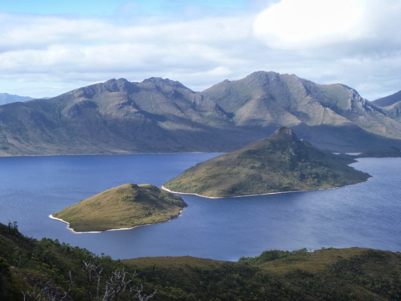
| Surprise Lake below Right Angle Peak |
.jpg) |
| Barrier Islands and Mt Solitary from Mt Jim Brown |
I continued on to
the summit of Mt Jim Brown, before the big drop down to the Lake Pedder
Impoundment. I managed to find a fairly open lead, with just a small band of
scrub near the bottom. Fortunately someone had been through recently and bashed
down the tea-tree for me! I was very relieved to make it to the shore of the
lake. This meant only about 10km to go to the dam. It was 5pm already though. I
chose to put on the iPod for the walk around the lake, hoping that would make
the time go faster. I was already exhausted, but the end was in sight.
.jpg) |
| Sun setting behind the Folded Range |
The lake
walking was frustrating. The mud was hard to read, and I found myself up to my
waist in places. The creek crossings were often deep and cold. I had been dry
for 7 days, but right at the end I found myself soaked. I was relieved to get
around the corner of Giblin Bay fairly quickly and hit the sandier shorelines,
making the walking a bit easier. Red Knoll was in view all the way, but it didn't
seem to get any closer. Gradually I was moving slower and slower, and time was
getting away from me. I crossed over McKay's Point through a grassy lead, then
I rested to watch the sunset. I was treated to a unique view of Mt Anne; her
peaky profile backed by pink skies was something to treasure. I resisted
getting the torch out, relying on the moon to help me navigate. The rocky shore
was getting slippery in places, so I decided that wading was easier. As I got
closer to Red Knoll, the shoreline became somewhat cliff-like in places. In
some places it was best to walk along the grassy tops until a scrub band was
reached then drop back to the water. I had to do this maybe 6 or 7 times. I had
planned to ascend Red Knoll and use the road down to the dam, but as it was
very dark, I wasn't confident in picking a good lead to the top. I just decided
to keep walking around the shore. Eventually I popped out on the road near the
dam. There was a brief shout of elation, but no one there to hear it. I could
see car lights down the road, and I feared that Alana had just given up on
waiting for me – it was 11pm after all. I wandered down to the Huon Camp ground
to check the car park, as well as log out in the log book. There were plenty of
cars there, so I was confident of getting a lift out the following morning if
needed. I thought I should go and check the other end of the dam to see if
Alana was there though. In hindsight, I should have walked along the dam wall,
I would have been seen easily with my torch, and it would have been flat, but I
foolishly took the road. Luckily Alana was at the other dam car park, and I
took off my wet gear and went to pick up my pack from the registration booth. A
bottle of coke was a welcome treat, and some stories were told on the trip back
to Hobart. It was 2:30am when I crawled into a friend's house and slept on the
floor. I didn't sleep long, up again in 4 hours ready to go and see some
friends for the day.
.jpg) |
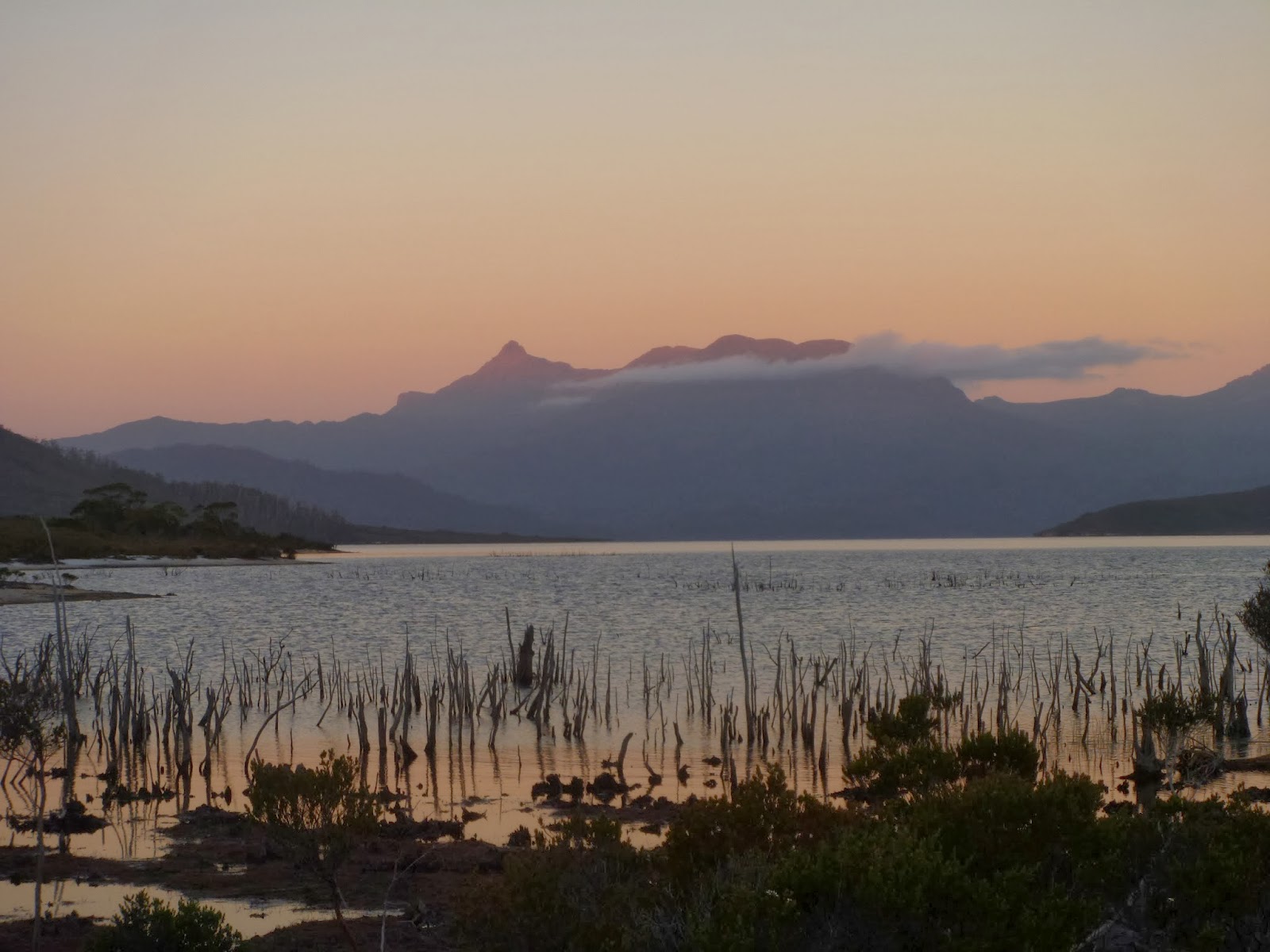
| Sunset over the Anne Range |
This was
one of the most rewarding trips I have done weather-wise, but it also made me
want to walk with others more regularly. Nearly all of my longer trips have
been solo, and it nearly cost me this time. My confidence was dented a little initially,
but I realized that I made it through, and I was fine. My tent is no longer
usable, the poles quite bent, and the fly ripped out of its anchor, but tents
can be replaced. I will go back one day, but as far as solo trips go, I hope
this is one of the last big solo trips I do.
As far
as advice for people wanting to do this trip goes, I have 3 tips:
1-
Do
it with a group. If things go pear shaped (it is quite possible up here, it is
exposed most of the way) you have others to provide some backup.
2-
Take
a bivy bag. In winds such as I experienced, I would have been fine just
bunkering down in a bivy. I later found out that the wind speed at Scott's Peak
was 154km/h – I can only imagine it was higher up on the range. I don't wish
such an experience on anyone.
3-
Carry
plenty of water. It only takes a few dry days to make the range very dry. I
found no water in yabby holes, and 3 of my campsites were dry.
I hope
you enjoyed the report and photos, and hopefully it inspires you to visit this
truly amazing place!
Happy
Walking!
Jared
.jpg&container=blogger&gadget=a&rewriteMime=image%2F*)
.jpg&container=blogger&gadget=a&rewriteMime=image%2F*)
.jpg&container=blogger&gadget=a&rewriteMime=image%2F*)
Very interesting blog and nice pictures. Brought back memories of my two solo trips along the range. In one of these I also experienced a severe February cold front change late in the afternoon; but fortunately found a tiny overhang beneath a cliff that was just large enough to pitch my tent in and shelter for the night. I was up on PB high camp on the day/night of the storm you also experienced and your description of what it was like in your tent in the storm is very much what I experienced. I can't emphasise enough to people that it is essential for your safety to carry a strong tent when walking in places as exposed as much of the Frankland Range is.
ReplyDelete